CREATED BY: Francois Dion - fdion@dionresearch.com
DESCRIPTION:
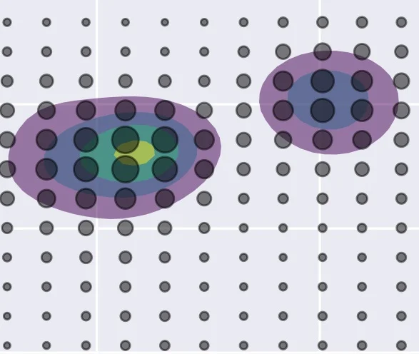
Map without a basemap.
Regional level of individuals with visualization skills as a two dimensional isometric density estimation, along with a density dot map. Using long and lat as x and y creates an approximation of a map, without using a base map.
Density gives us North America and Europe, with visual cues to South America, Africa, Asia & Oceania (mostly Australia). High visualization skills (viridis scale) concentrated on US east coast, mostly due to NYC.
PROCESS FOR CREATION:
Jupyter notebook with python, export to svg or png.


